A few weeks ago, thanks to a tweet from Thomas Freudenberg, I discovered bikemap.net, a Web2.0 web application that allows users to post their favorite bike routes and track their trips, mapping them using Google Maps.
The things I like the most is that, unlike many other track mapping sites (included the Nike+ site), it gives you the option to follow the road and not just draw straight lines, so you don’t have to add 100 small segments just to follow the path of a mountain pass street with many switchbacks.
The other awesome feature is the altitude profile: it’s automatically created using the altitude metadata of Google Map, and it’s incredibly precise, even with non US areas. The graph blow is my Sunday morning trip that starts directly from my door.

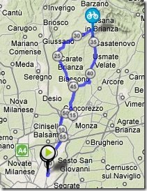
As you might notice, there is a vertical row in the graph: you can move it with the mouse, and, on the map, you will see an icon following the path as in the image below:

But you’d better try it by yourself on the trip’s page directly on bikemap.net: Milano – Besana Brianza.
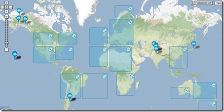
At the moment there are around 45.000 tracks mapped on the site, most of which, around 42k, in Europe, but also around two thousands in the US and around 250 in Australia and even 32 mapped in New Zealand.
If you are a biker, you’d better check it out. It’s an awesome site, neatly implemented with a great user experience, and a great example of integration with GoogleMap. And if you are interested in looking at my tracks, I’m codeclimber on BikeMap.net


