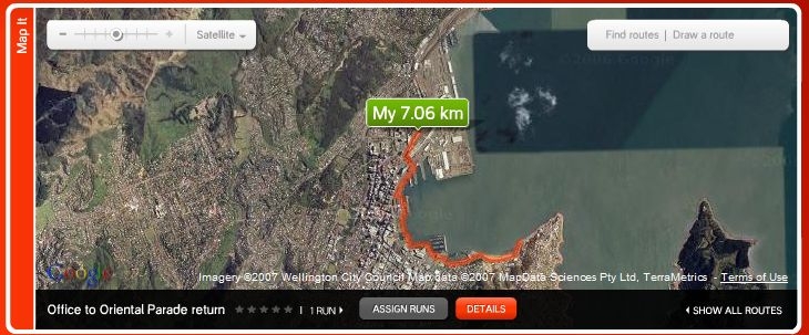
Wellington waterfront is so beautiful and relaxing that you cannot avoid spending most of your spare time wandering along the promenade that surround all the Lambton Harbour. So, when it's not raining or the wind is under 20 knots I spend my lunch break running from my office till the end of Oriental Parade and return.
I think that running is the best way to spend your lunch break: you get fit, you eat less, you have a "real" break from your work stuff and you enjoy the warmest hours of the day outdoor. And now that the sunset is at 5pm, it's also the only way I can run outdoor during weekdays.
What is this map? It's one of the 2 new features introduced on the NikePlus web site in the last month: Map your routes and public profile.
Map your running routes
Now you can draw on a Google map your running routes, you can make them public, and you can share them with you runner friends (here is the map of my lunch break running route). And you can also search for all the routes in a specific city.
Here are 2 screenshots with all the public routes in Wellington and Milano:
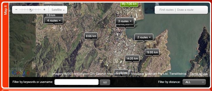
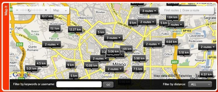
The only problem is see is that the map is constrained in the 700x 300 area of the main window of NikePlus: this forces to constantly drag the map around to the details. A more standard squared map would have been a better solution.
Public profile
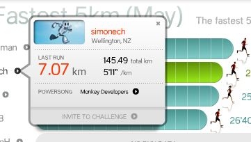 With the intent of increasing the feeling of being inside a community, the other new feature introduced is the public profile. Both in the NikePlus forums and when looking at the competitors in your challenges, you can see a small popup with some information about the user: where he is from, how many kms he ran, his average speed, his latest run and his "power song".
On the left you can see my public profile. My power song is the infamous "Developers, Developers, Developers, Developers" by Digital Droo (featuring Steve Ballmer). If you want to put it on you iPod, here is the mp3.